Health
Research Plane Surveys Connecticut River Valley for Hazardous Mineral

A research plane is currently conducting aerial surveys over the Connecticut River Valley to locate deposits of a hazardous mineral known as pyrrhotite. This mineral poses significant risks in construction materials, particularly in cement, as it can lead to structural weaknesses and potential foundation failures. The operation is being led by the United States Geological Survey (USGS) as part of its Earth Mapping Resources Initiative (MRI).
The survey focuses primarily on areas in Connecticut and Massachusetts, while also extending to parts of Rhode Island, Vermont, and New Hampshire. According to the USGS, the mapping effort aims to modernize geological understanding of both surface and subsurface conditions across the region. It is expected to provide valuable insights into geological hazards, including potential earthquakes and landslides, and assist in mine waste remediation and resource recovery.
Details of the Aerial Survey
The flights will be conducted from Robertson Airport in Plainville, Connecticut, and the plane will typically operate at altitudes of approximately 300 feet above ground level. Equipped with advanced tools designed to measure magnetic fields and low-level radiation emitted by rocks, the aircraft is clearly distinguishable by a long “boom” extending from its cabin. The USGS has emphasized that the instruments used pose no emissions risk to humans, animals, or plant life, and that no video or photography will be taken during the flights.
Meghan Seremet, Connecticut’s state geologist, expressed enthusiasm about the survey, stating, “This survey covers a large portion of southern New England. It will provide new insights into Connecticut’s bedrock that wouldn’t be possible without modern geophysical tools.” She added that collaboration with Massachusetts and Rhode Island would enhance mapping efforts along state borders, ultimately aiding the Connecticut Geological Survey in understanding geological hazards statewide.
Implications and Objectives
The information gathered from this survey will contribute to the development of three-dimensional geological maps, highlighting both resources and hazards. Jamey Jones, science coordinator for the USGS Earth MRI, noted the broader significance of the project, remarking, “Increasing knowledge of New England’s geologic framework will help with national priorities, like earthquake and landslide hazards, water availability, and sourcing critical minerals.”
The survey is set to continue throughout the fall, reflecting a concerted effort to address regional geological concerns while also supporting national initiatives. This collaborative mapping project underscores the importance of understanding local geological hazards like pyrrhotite, which have significant implications for infrastructure safety and sustainability in New England.


Kim Kardashian Dazzles in Sheer Brown Dress During Photoshoot

Researchers Unveil Advanced Carbon Dioxide Energy Storage System

Navigating Neurodiversity: The Movement’s Challenges and Future

Record-Low Price on Apple MacBook Air M4 During Black Friday Sale
Transform Your Holiday with This $200 Off Pre-Lit Christmas Tree
New Findings on HSL Protein Transform Understanding of Obesity

Enhance Your Travel Experience with New Google Maps Features

St. Louis Community Unites for Veterans, Youth, and Education Initiatives
Transform Your Holiday Decor With This $200 Off Pre-Lit Tree

Discover the Top 10 Calorie Counting Apps of 2025

Bella Hadid Shares Health Update After Treatment for Lyme Disease

Erin Bates Shares Recovery Update Following Sepsis Complications

Discover 2025’s Top GPUs for Exceptional 4K Gaming Performance

Electric Moto Influencer Surronster Arrested in Tijuana

Discover How to Reverse Image Search Using ChatGPT Effortlessly

Meta Initiates $60B AI Data Center Expansion, Starting in Ohio

Recovering a Suspended TikTok Account: A Step-by-Step Guide

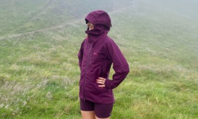
Tested: Rab Firewall Mountain Jacket Survives Harsh Conditions
-
 Technology4 months ago
Discover the Top 10 Calorie Counting Apps of 2025
-
 Health2 months ago
Bella Hadid Shares Health Update After Treatment for Lyme Disease
-
 Health3 months ago
Erin Bates Shares Recovery Update Following Sepsis Complications
-
 Technology3 weeks ago
Discover 2025’s Top GPUs for Exceptional 4K Gaming Performance
-
 Technology2 months ago
Electric Moto Influencer Surronster Arrested in Tijuana
-
 Technology4 months ago
Discover How to Reverse Image Search Using ChatGPT Effortlessly
-
 Technology4 months ago
Meta Initiates $60B AI Data Center Expansion, Starting in Ohio
-
 Technology4 months ago
Recovering a Suspended TikTok Account: A Step-by-Step Guide
-
 Health4 months ago
Tested: Rab Firewall Mountain Jacket Survives Harsh Conditions
-

 Lifestyle4 months ago
Belton Family Reunites After Daughter Survives Hill Country Floods
-

 Technology3 months ago
Uncovering the Top Five Most Challenging Motorcycles to Ride
-

 Technology4 weeks ago
Discover the Best Wireless Earbuds for Every Lifestyle