Science
Archaeologists Map 300,000 km of Roman Roads, Expanding History
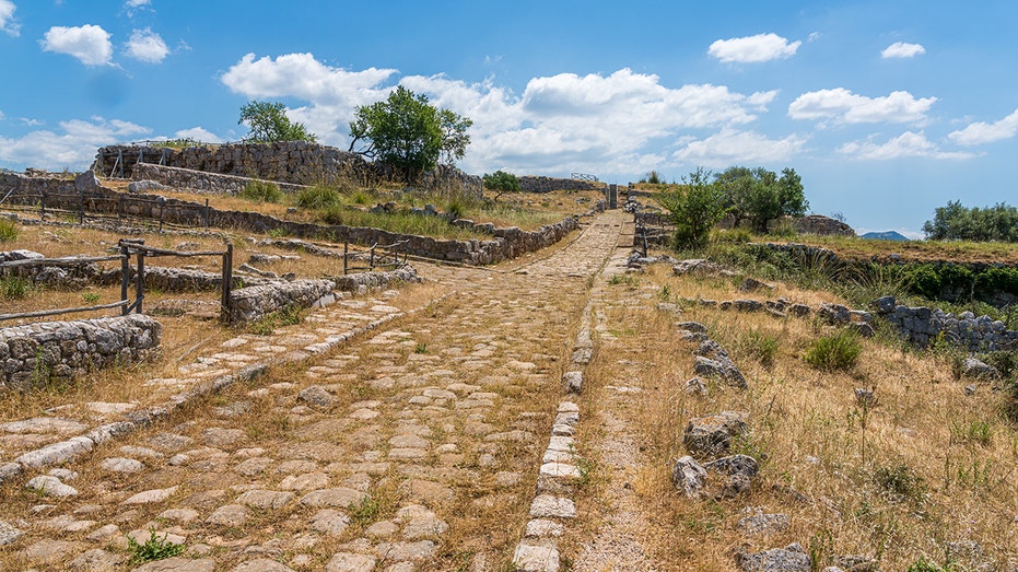
A recent discovery by an amateur metal detectorist in Gloucestershire, England, has led to the unearthing of a significant Roman settlement dating back 2,000 years. This find includes a villa and building remains, igniting renewed interest in the extensive Roman road network. According to a new digital atlas released this week, the actual length of these roads is now estimated at nearly 300,000 kilometers (approximately 186,000 miles), which is over 100,000 kilometers longer than previously recorded.
The study, known as Itiner-e, represents the most comprehensive mapping of Roman roadways to date. The last major atlas was published 25 years ago, relying on incomplete records and analogue methods. With advancements in digital techniques, researchers have been able to utilize satellite imagery and aerial photography to enhance their understanding of these ancient routes, as reported by The Associated Press.
Innovative Techniques Reveal Hidden Roads
A team of archaeologists spent five years analyzing historical documents, ancient journals, and the locations of milestones. They employed modern tools to examine satellite images, including previously digitized photographs from World War II. When ancient texts suggested potential routes in specific areas, researchers scrutinized the terrain for subtle indications, such as changes in vegetation, soil types, and variations in elevation.
“It becomes a massive game of connecting the dots on a continental scale,” said Tom Brughmans, an archaeologist and co-author of the study published in Scientific Data. The digital atlas not only outlines the main highways of the Roman Empire but also identifies a vast network of secondary roads that linked villas, agricultural lands, and military installations.
The newly released map extends from Spain to Syria, connecting more than 5,000 ancient settlements. Previously, the extent of Roman roads was estimated at approximately 188,000 kilometers (117,000 miles). The new findings significantly enhance knowledge of ancient roads in under-documented regions, including North Africa and the interior plains of France.
Impact on Historical Understanding
The atlas, named Itiner-e in homage to ancient Roman travel registers, combines historical documents with modern geographic information system (GIS) analysis, LiDAR technology, and crowdsourced archaeological data. Despite the extensive mapping, the report indicates that only 2% to 3% of these roads have a “high certainty” classification, meaning they have clear physical traces that remain today.
The comprehensive nature of this study allows historians and researchers to model various trends related to the movement of people, goods, and ideas during Roman times. This includes significant events like the rise of Christianity and the spread of ancient diseases across the empire.
“The Romans left a huge impact with this road network,” stated Adam Pažout from the Autonomous University of Barcelona. The study’s findings could reshape scholarship on imperial logistics, trade networks, and cultural exchanges, making it a valuable resource for historians and academics.
The data and an interactive map are freely accessible to scholars and the public at itiner-e.org. This platform enables users to explore detailed routes, milestones, and ancient settlements, providing a window into the sophisticated infrastructure that supported one of history’s most influential empires.
As archaeological discoveries continue to shed light on ancient civilizations, they not only enrich academic discourse but also captivate the interest of the general public. Recently, archaeologists in Italy uncovered a massive stone basin in the ancient ruins of Gabii, dating back more than 2,000 years, further illustrating the enduring legacy of the Roman Empire.


Revolutionary Photonic Ski-Jump Could Miniaturize LiDAR Systems

Couples Detox from Plastics in New Netflix Doc: Can It Boost Fertility?

Aventon Launches Affordable Full-Suspension Electric Mountain Bike

Discover Eight Must-Try Restaurants This Spring Season

UC Irvine Team Unveils Innovative Ion Pump for Water Treatment

One-Third of Americans Trim Daily Expenses for Healthcare Needs

Apple Secures First Oscar in Three Years with F1: The Movie

Fourth Graders Celebrate St. Patrick’s Day with Creative Weather Drawings

Kim Kardashian Dazzles at Vanity Fair Oscars Party 2026

Nostradamus’ 2026 Predictions: Star Death and Dark Events Loom

Breakthroughs and Challenges Await Science in 2026

Electric Moto Influencer Surronster Arrested in Tijuana

OpenAI to Implement Age Verification for ChatGPT by December 2025

Discover the Top 10 Calorie Counting Apps of 2025

Bella Hadid Shares Health Update After Treatment for Lyme Disease

Analysts Project Stronger Growth for Apple’s iPhone 17 Lineup

Japanese Study Finds Rose Oil Can Increase Brain Gray Matter

Top 10 Penny Stocks to Watch in 2026 for Strong Returns
-
 Science3 months ago
Nostradamus’ 2026 Predictions: Star Death and Dark Events Loom
-
 Science4 months ago
Breakthroughs and Challenges Await Science in 2026
-
 Technology7 months ago
Electric Moto Influencer Surronster Arrested in Tijuana
-
 Technology4 months ago
OpenAI to Implement Age Verification for ChatGPT by December 2025
-
 Technology9 months ago
Discover the Top 10 Calorie Counting Apps of 2025
-
 Health7 months ago
Bella Hadid Shares Health Update After Treatment for Lyme Disease
-
 Health7 months ago
Analysts Project Stronger Growth for Apple’s iPhone 17 Lineup
-
 Technology4 months ago
Top 10 Penny Stocks to Watch in 2026 for Strong Returns
-
 Health7 months ago
Japanese Study Finds Rose Oil Can Increase Brain Gray Matter
-

 Science6 months ago
Starship V3 Set for 2026 Launch After Successful Final Test of Version 2
-

 Technology1 month ago
Nvidia GTC 2026: Major Announcements Expected for AI and Hardware
-

 Education7 months ago
Harvard Secures Court Victory Over Federal Funding Cuts